Botany Bay
was closed. No, not the Australian Penal
colony. Rather the wildlife preserve made up of two 18th century
plantations just across the wetland waterway from our campground. “Closed for Special Hunt” the sign read.
Special hunts are called for as needed at all wildlife areas here in South
Carolina. That’s how they keep the
wildlife populations matched with the food supply, or try to.
So we headed
a bit farther west on route 174 to a fresh seafood wagon near Store Creek. We
had our picnic lunch along so a basket of fresh shrimp, fries and hushpuppies
filled the bill.
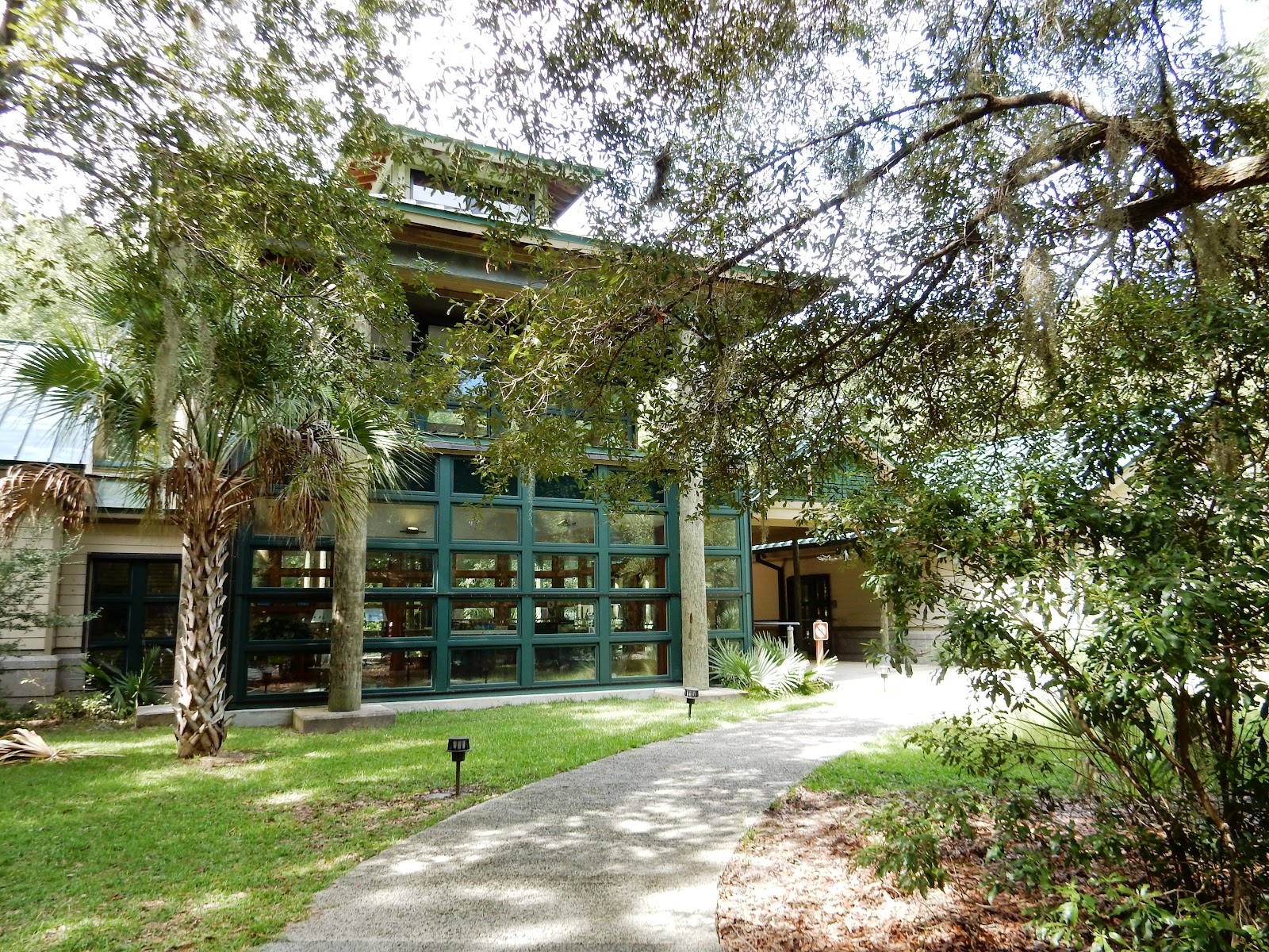 Then back
toward the beach and south on Palmetto Road to the State Park Education Center.
Then back
toward the beach and south on Palmetto Road to the State Park Education Center. 
 In addition to a nice nature center there are exhibits of prehistoric Indian and
18th and 19th century settler and plantation artifacts
dug up by beachcombers and scientists over the years.
In addition to a nice nature center there are exhibits of prehistoric Indian and
18th and 19th century settler and plantation artifacts
dug up by beachcombers and scientists over the years.
 Outside are
several miles of walks through and along waterways, swamps, and forests of
loblolly pines, live oaks and palmetto palms.
“Don’t feed the alligators” the rangers in the Center told
everyone. We saw none, but then, I doubt
we would have purposely gotten close enough to hand one some crackers if we
had.
Outside are
several miles of walks through and along waterways, swamps, and forests of
loblolly pines, live oaks and palmetto palms.
“Don’t feed the alligators” the rangers in the Center told
everyone. We saw none, but then, I doubt
we would have purposely gotten close enough to hand one some crackers if we
had.
 We took two
of the shorter walks. First, the one to
the Center boat dock. The tide was out
so the ‘Plough’ mud was visible and the tiny mud crabs were scurrying about on
the surface looking for food.
We took two
of the shorter walks. First, the one to
the Center boat dock. The tide was out
so the ‘Plough’ mud was visible and the tiny mud crabs were scurrying about on
the surface looking for food.
 When the
tide rolls back in these beds will be well below water and safe for 12 hours
from seagulls again.
When the
tide rolls back in these beds will be well below water and safe for 12 hours
from seagulls again. The second
walk was historical as well as naturally beautiful. In the 1840’s Alexander Bache, a grandson of
Benjamin Franklin, led a US Geologic survey of the Southeastern Coast of the US
and began it here on Edisto Island. Edisto
was considered the most level of all barrier islands, hence the best first
place to get a line of sight for the base line by which all other triangulation's of measurement would be taken.
The second
walk was historical as well as naturally beautiful. In the 1840’s Alexander Bache, a grandson of
Benjamin Franklin, led a US Geologic survey of the Southeastern Coast of the US
and began it here on Edisto Island. Edisto
was considered the most level of all barrier islands, hence the best first
place to get a line of sight for the base line by which all other triangulation's of measurement would be taken. 


 The New
England granite markers at each end of the nearly 7 mile base line still stand
where he placed them in 1849, and this one is marked by this historic trail
honoring him and all of the men white and slave, who worked to make the coast
more safe with accurate measurements for local and international shipping.
The New
England granite markers at each end of the nearly 7 mile base line still stand
where he placed them in 1849, and this one is marked by this historic trail
honoring him and all of the men white and slave, who worked to make the coast
more safe with accurate measurements for local and international shipping. Little did
anyone know that just 12 years later these measurements would allow Confederate
blockade runners to sneak easier through the islands to there home ports, and
Union gunboats to edge into shore to support landings that would remove most of
the barrier islands from the Confederacy early in the conflict.
Little did
anyone know that just 12 years later these measurements would allow Confederate
blockade runners to sneak easier through the islands to there home ports, and
Union gunboats to edge into shore to support landings that would remove most of
the barrier islands from the Confederacy early in the conflict.
 Back to the
campground and onto the beach once more for a bit of splashing and
reading. But today was cooler and
windier than the past two so we headed to camp and started a fire. Mona cooked Sweet potatoes in the fire and
kielbasa on it. Um, Um, GOOD!
Back to the
campground and onto the beach once more for a bit of splashing and
reading. But today was cooler and
windier than the past two so we headed to camp and started a fire. Mona cooked Sweet potatoes in the fire and
kielbasa on it. Um, Um, GOOD!
It’s
darkening now. I’m sure the sunset at
Bay Point was wonderful tonight. We enjoyed the colors of the sky through our
campground palms from our campfire.
Tomorrow we
check out of here and try to fit FROG’s 13’ height under the live oaks at
Edisto UMC. If it doesn’t work out, we’ll
decide what to do from there. NO
DEADLINES! Except…
… The
Confederate submarine Hunley restoration museum in Charleston is open only
Saturdays and Sundays, and we just read in this week’s paper that the ALL CHARLESTON
USED BOOK SALE is taking place this weekend at the Shrine Hall. No deadlines, but definite destinations for
Saturday!
-Ken
No comments:
Post a Comment